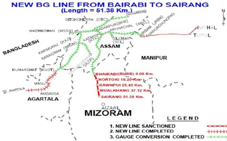
Bairabi-Sairang Line
The Bairabi-Sairang Line is located near Aizawl, the capital of Mizoram. The Bairabi-Sairang Line is a railway line from Bairabi to Sairang under the Northeast Frontier Railway Zone of Indian Railways. Route and Length: The project is a 51.38 km long single track broad gauge