

Why in the News
-
On July 22, 2025, an earthquake with a magnitude of 6.3 occurred off the east coast of the Kamchatka Peninsula in Russia.
-
Due to its location along the Pacific Ring of Fire, this area is extremely vulnerable to volcanic and seismic activity.
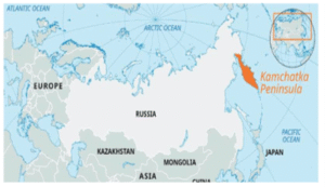
Location and Geography
-
Situated in Russia’s far east, between:
-
Okhotsk Sea (west)
-
Bering Sea and Pacific Ocean (east)
-
-
Lies in the administrative region of Kamchatka Krai
-
Dimensions:
-
Approximately 1,200 km from north to south
-
At its broadest, it is roughly 480 km wide
-
Roughly 370,000 square kilometres
-
-
About the same size as New Zealand
-
Among the world’s largest peninsulas
Geothermal and Volcanic Features
-
Resides within the Pacific Ring of Fire
-
Referred to as the “Land of Fire and Ice”
-
With more than 150 volcanoes, including 29 that are currently active
-
One of the geothermal hotspots with the highest concentration in the world
Individuals and Communities
-
Population: approximately 300,000
-
Less than one person per square kilometre is the extremely low population density
-
Petropavlovsk-Kamchatsky is the regional capital
The Climate
-
Severe and harsh:
-
Winters that are long, cold, and snowy
-
Cool, rainy summers
-
Natural Features and Topography
-
The Eastern Range’s Klyuchevskaya Sopka stratovolcano is the highest point
-
The Kuril Island chain stretches from the southernmost tip of Kamchatka to Hokkaido Island in Japan
कामचटका प्रायद्वीप:
समाचार में क्यों
-
22 जुलाई 2025 को, रूस के कामचटका प्रायद्वीप के पूर्वी तट पर 6.3 तीव्रता का भूकंप आया।
-
प्रशांत रिंग ऑफ फायर के साथ स्थित होने के कारण यह क्षेत्र ज्वालामुखीय और भूकंपीय गतिविधियों के लिए अत्यधिक संवेदनशील है।
स्थान और भूगोल
-
रूस के सुदूर पूर्व में स्थित, इसके बीच:
-
ओखोत्स्क सागर (पश्चिम)
-
बेरिंग सागर और प्रशांत महासागर (पूर्व)
-
-
प्रशासनिक क्षेत्र: कामचटका क्राय
-
माप:
-
उत्तर से दक्षिण तक लगभग 1,200 किलोमीटर
-
सबसे चौड़े हिस्से पर लगभग 480 किलोमीटर चौड़ा
-
लगभग 3,70,000 वर्ग किलोमीटर
-
-
आकार में लगभग न्यूज़ीलैंड के बराबर
-
दुनिया के सबसे बड़े प्रायद्वीपों में से एक
भूतापीय और ज्वालामुखीय विशेषताएँ
-
प्रशांत रिंग ऑफ फायर के भीतर स्थित
-
“आग और बर्फ की भूमि” के रूप में जाना जाता है
-
150 से अधिक ज्वालामुखी, जिनमें से 29 वर्तमान में सक्रिय हैं
-
दुनिया के सबसे अधिक सघन भूतापीय केंद्रों में से एक
व्यक्तिगत और सामुदायिक जानकारी
-
जनसंख्या: लगभग 3,00,000
-
जनसंख्या घनत्व अत्यंत कम — प्रति वर्ग किलोमीटर एक व्यक्ति से भी कम
-
क्षेत्रीय राजधानी: पेट्रोपावलोव्स्क-कामचात्स्की
जलवायु
-
कठोर और गंभीर:
-
लंबे, ठंडे और बर्फीले सर्दियाँ
-
ठंडी, वर्षायुक्त गर्मियाँ
-
प्राकृतिक विशेषताएँ और स्थलाकृति
-
पूर्वी पर्वत श्रृंखला का क्ल्युचेव्स्काया सोप्का स्ट्रैटोवोल्केनो सबसे ऊँचा बिंदु है
-
कुरील द्वीप श्रृंखला कामचटका के दक्षिणी सिरे से लेकर जापान के होक्काइडो द्वीप तक फैली हुई है |

