
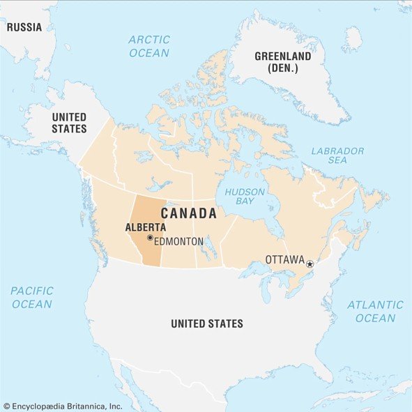
Alberta Plateau lies in western Canada, mostly covering the southern and central parts of the province of Alberta.
It forms a transitional zone between the Rocky Mountains to the west and the Interior Plains to the east.
The plateau is part of the Western Cordillera system and comprises ancient sedimentary rock formations.
The average elevation ranges between 600 m and 1,200 m, gradually sloping from west to east.
Major rivers like the Peace River and Athabasca River flow across the plateau, carving out wide valleys.
The Glacial activity during the Pleistocene period shaped the plateau’s undulating plains and depressions.
The plateau includes parts of the Foothills, which act as a transitional belt between the Rockies and plains.
Soils are mainly chernozem (black soils) and luvisolic, making the area suitable for wheat and barley cultivation.
The plateau falls within the temperate continental climatic zone with cold winters and warm summers.
Rainfall is moderate (around 400–500 mm/year), more concentrated in the summer months.
Mixed grass prairie and aspen parkland are dominant natural vegetation types in the southern part.
The northern section of the plateau has boreal forests, composed mainly of spruce, fir, and pine.
Oil sands and natural gas reserves are abundant, particularly near Fort McMurray and Peace River region.
The Alberta Plateau is a core region for Canada’s energy sector, especially for oil extraction and refining.
Important urban centres like Calgary and Edmonton lie near or within the plateau zone.
Cattle ranching, especially beef production, is a major land-use activity in the southern foothills.
The plateau has several glacial lakes and wetlands, which are crucial for migratory bird habitats.
Wind and solar energy projects are expanding on the plateau due to the open topography and sun exposure.
The plateau is also prone to grassland fires during dry summers, affecting local ecology and air quality.
The Athabasca Oil Sands, located on the plateau, are among the largest petroleum deposits in the world.
Strip mining and tailing ponds related to oil sands extraction pose major ecological challenges.
Conservation efforts include protected areas like Wood Buffalo National Park and Elk Island National Park.
Alberta Plateau plays a key role in Canada’s agriculture, energy production, and environmental policy debates.
अल्बर्टा पठार (कनाडा):-
अल्बर्टा पठार पश्चिमी कनाडा में स्थित है, जो मुख्यतः प्रांत अल्बर्टा के दक्षिणी और मध्य भाग को आवृत करता है।
यह पठार रॉकी पर्वत के पश्चिम में और आंतरिक मैदानों के पूर्व में संक्रमण क्षेत्र बनाता है।
यह पश्चिमी कॉर्डिलेरा प्रणाली का भाग है और इसमें प्राचीन अवसादी चट्टानों की संरचना पाई जाती है।
इसकी औसत ऊँचाई 600 से 1200 मीटर के बीच होती है और यह पश्चिम से पूर्व की ओर ढलान बनाता है।
प्रमुख नदियाँ जैसे पीस नदी और एथाबास्का नदी इस पठार को काटते हुए विस्तृत घाटियाँ बनाती हैं।
प्लीस्टोसीन युग के दौरान हुई हिमानी क्रिया ने पठार की तरंगित भूमि और गहरे अवनमन तैयार किए।
पठार में फुटहिल्स क्षेत्र भी शामिल हैं जो रॉकीज़ और मैदानों के बीच स्थित संक्रमण बेल्ट है।
मिट्टियाँ मुख्यतः चेरनोज़ेम (काली मिट्टी) और लुवीसोलिक होती हैं, जो गेहूँ और जौ की खेती के लिए उपयुक्त हैं।
पठार शीतोष्ण महाद्वीपीय जलवायु क्षेत्र में आता है, जहाँ सर्दियाँ ठंडी और गर्मियाँ गर्म होती हैं।
वर्षा औसतन 400–500 मिमी/वर्ष होती है और यह मुख्यतः गर्मी के महीनों में केंद्रित रहती है।
दक्षिणी भाग में मिश्रित घास का मैदान और एस्पन पार्कलैंड प्रमुख प्राकृतिक वनस्पतियाँ हैं।
उत्तर का भाग बोरियल वनों से ढका है, जिनमें मुख्यतः स्प्रूस, फ़र और चीड़ जैसे वृक्ष पाए जाते हैं।
तेल बालू और प्राकृतिक गैस भंडार यहाँ प्रचुर मात्रा में पाए जाते हैं, विशेषतः फोर्ट मैकमरे और पीस नदी क्षेत्र में।
अल्बर्टा पठार कनाडा के ऊर्जा क्षेत्र का केंद्र है, विशेषकर तेल निष्कर्षण और परिष्करण के लिए।
कालगारी और एडमंटन जैसे महत्वपूर्ण शहरी केंद्र इस पठार क्षेत्र के पास या भीतर स्थित हैं।
दक्षिणी फुटहिल्स में पशुपालन, विशेषकर गोजातीय पालन (बीफ उत्पादन) एक प्रमुख भूमि उपयोग है।
पठार पर कई हिमनदीय झीलें और आर्द्रभूमियाँ हैं जो प्रवासी पक्षियों के आवास के लिए महत्वपूर्ण हैं।
पवन और सौर ऊर्जा परियोजनाएँ यहाँ तेजी से बढ़ रही हैं क्योंकि भूआकृति खुली और धूप प्रचुर है।
ग्रीष्म ऋतु में शुष्कता के कारण पठार पर घास के मैदानों में आग लगना एक सामान्य पारिस्थितिकीय संकट है।
एथाबास्का तेल बालू, जो पठार पर स्थित है, विश्व के सबसे बड़े पेट्रोलियम भंडारों में से एक है।
पट्टी खनन और तेल निष्कर्षण के टेलिंग तालाब पर्यावरणीय दृष्टि से गंभीर संकट उत्पन्न करते हैं।
वुड बफ़ेलो राष्ट्रीय उद्यान और एल्क आइलैंड राष्ट्रीय उद्यान जैसे संरक्षित क्षेत्र संरक्षण के प्रयासों में शामिल हैं।
अल्बर्टा पठार, कनाडा की कृषि, ऊर्जा उत्पादन और पर्यावरण नीति बहसों में एक प्रमुख भूमिका निभाता है।

 Mon - Fri: 09:00 - 20:00 Sat & Sun : 10:30 - 18:00

