

Why in the News
-
Researchers from IIT Indore, ICIMOD (Nepal), and the United States (1980–2020) discovered:
-
Over the past forty years, the Gangotri Glacier system has lost roughly ten percent of its snowmelt flow.
-
The Ganga’s hydrology is changing as the amount of snowmelt contributing to river flow steadily decreases.
-
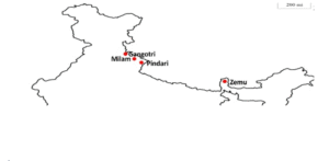
The Gangotri Glacier
-
Largest glacier in the Himalayan Garhwal region.
-
Source of the Ganga’s headstream, the Bhagirathi river.
-
About 30 km in length and 143 square kilometres in area.
-
Snout at Gaumukh Cave, which is regarded as the Ganga’s sacred source.
-
Location:
-
Uttarakhand’s Uttarkashi district.
-
Within the national park of Gangotri.
-
In the central Himalayan region, a portion of the Greater Himalaya.
-
Encircled by peaks such as the Bhagirathi group, Meru, Thalay Sagar, and Shivling.
-
Key Features
-
Fed by:
-
Snowmelt
-
Glacier melt
-
Rainfall
-
Base flow
-
-
Contributes ~25% of Ganga’s water in non-monsoon months.
-
Flow composition (1980–2020):
-
Snowmelt – 64%
-
Glacier melt – 21%
-
Rainfall-runoff – 11%
-
Base flow – 4%
-
Climate Change Impact
-
Snowmelt share declined:
-
73% (1980–90) → 63% (2010–20).
-
-
Average temperature rise:
-
+0.5°C in 2001–20 compared to 1980–2000.
-
-
Peak flow timing shifted:
-
From August to July (earlier melting).
-
-
Rainfall-runoff and base flow contribution increasing.
-
Glacier snout retreating steadily.
-
Himalayan studies show ~46 cm annual ice thickness loss.
Strategic Importance
-
Water security:
-
Supports millions in the Ganga basin.
-
-
Hydropower:
-
Seasonal discharge changes affect electricity output.
-
-
Agriculture:
-
Shifts in flow patterns may cause irrigation shortages.
-
-
Cultural significance:
-
Sacred as the origin of the Ganga, central to Hindu faith.
-
गंगोत्री हिमनदी:
क्यों खबरों में
-
IIT इंदौर, ICIMOD (नेपाल) और अमेरिका के शोधकर्ताओं (1980–2020) ने पाया:
-
पिछले चालीस वर्षों में गंगोत्री हिमनदी प्रणाली ने लगभग दस प्रतिशत हिमपिघल प्रवाह खो दिया है।
-
गंगा की जलविज्ञान प्रणाली बदल रही है क्योंकि नदी प्रवाह में हिमपिघल का योगदान लगातार कम हो रहा है।
-
गंगोत्री हिमनदी के बारे में
-
हिमालयी गढ़वाल क्षेत्र की सबसे बड़ी हिमनदी।
-
गंगा की उद्गम धारा, भागीरथी नदी का स्रोत।
-
लगभग 30 किलोमीटर लंबी और 143 वर्ग किलोमीटर क्षेत्रफल।
-
गौमुख गुफा में इसका मुहाना, जिसे गंगा का पवित्र स्रोत माना जाता है।
-
स्थान:
-
उत्तराखंड के उत्तरकाशी ज़िले में।
-
गंगोत्री राष्ट्रीय उद्यान के भीतर।
-
मध्य हिमालयी क्षेत्र में, ग्रेटर हिमालय का हिस्सा।
-
भागीरथी समूह, मेरु, थलै सागर और शिवलिंग जैसे शिखरों से घिरी हुई।
-
मुख्य विशेषताएं
-
निम्न स्रोतों से पोषित:
-
हिमपिघल
-
हिमनदी पिघल
-
वर्षा
-
आधार प्रवाह
-
-
गैर-मानसून महीनों में गंगा के जल में लगभग 25% योगदान।
-
प्रवाह संरचना (1980–2020):
-
हिमपिघल – 64%
-
हिमनदी पिघल – 21%
-
वर्षा-बहाव – 11%
-
आधार प्रवाह – 4%
-
जलवायु परिवर्तन का प्रभाव
-
हिमपिघल का हिस्सा घटा:
-
73% (1980–90) → 63% (2010–20)।
-
-
औसत तापमान वृद्धि:
-
2001–20 में +0.5°C (1980–2000 की तुलना में)।
-
-
अधिकतम प्रवाह का समय बदला:
-
अगस्त से जुलाई (जल्दी पिघलना)।
-
-
वर्षा-बहाव और आधार प्रवाह का योगदान बढ़ रहा है।
-
हिमनदी का मुहाना लगातार पीछे हट रहा है।
-
हिमालयी अध्ययनों में प्रति वर्ष ~46 सेमी हिम मोटाई का नुकसान पाया गया।
सामरिक महत्व
-
जल सुरक्षा:
-
गंगा बेसिन में करोड़ों लोगों को सहारा।
-
-
जलविद्युत:
-
मौसमी प्रवाह परिवर्तन से बिजली उत्पादन प्रभावित।
-
-
कृषि:
-
प्रवाह पैटर्न में बदलाव से सिंचाई की कमी हो सकती है।
-
-
सांस्कृतिक महत्व:
-
गंगा का उद्गम स्थल होने के कारण पवित्र, हिंदू आस्था का केंद्र।
-

